| ||

Fri 2025-07-18
Thu 2025-07-17
Wed 2025-07-16
Tue 2025-07-15
Mon 2025-07-14
Sun 2025-07-13
Fri 2025-07-11
Wed 2025-07-09
Tue 2025-07-08
Search
Archives
2024
12 11 10 09 08 07 06 05 04 03 02 01
2023
2022
2021
2020
2019
2018
2017
2016
2015
2014
2013
2012
2011
2010
2009
2008
2007
2006
2005
2004
2003
One good site
MDN
Nelson Minar
Blog licensed under a Creative Commons License
|
The very first radio navigation for aircraft was the Low-frequency
radio range. Marvellously simple idea: a directional radio station
broadcasts the Morse code for A · – to the north and south,
and N – · to the east and west. You listen to that
transmission in your headset. You listen to the station in your
airplane; if you hear A you're north or south of the station, N east or
west. But if you're directly NW, NE, SW, or SE of the station you hear
both A and N overlapping and merging into a single steady tone. Fly that
tone and you're flying in a straight line right to or from the beacon.
Of course the station doesn't have to be oriented to north, the actual
navigation network had some 400 stations in the US defining a network of
airways.
Aviation enthusiasts WWRB have built a working four course range, demonstrated in the video above. Skip to 4:28 for a technical explanation or 7:17 for a demo flight. Four course ranges were decommissioned about 40 years ago in favour of VOR, the system we use today. VOR is the same principle but lets you fly any bearing and uses electronics instead of sound to track the radial. 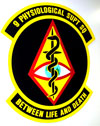 My first real flight with a pilot's license was Sunday, up to Marysville Airport to
visit nearby Beale Air Force
Base. Beale is home to the
U-2 and
RQ-4 drone; the 9th
Medical Group supports the U-2 pilots with high altitude medical
expertise. Once a month they offer abbreviated
high altitude training to civilian pilots.
My first real flight with a pilot's license was Sunday, up to Marysville Airport to
visit nearby Beale Air Force
Base. Beale is home to the
U-2 and
RQ-4 drone; the 9th
Medical Group supports the U-2 pilots with high altitude medical
expertise. Once a month they offer abbreviated
high altitude training to civilian pilots.
Hypoxia is a real threat to general aviation pilots. Our planes only go up to 15,000 feet or so, but they're almost always unpressurized and often don't have any oxygen on board. Legally I can fly up to 12,500 feet without any supplemental oxygen. That may not be wise, particularly since one of the symptoms of hypoxia is euphoria; you may not even recognize a problem. Our training started with four hours of ground briefing. Then the good part, an hour in the high altitude simulation chamber for a "flight". The hardest part for me was the half hour of pure oxygen through a mask at sea level: a bit of suffocation anxiety. Once we'd lowered our nitrogen concentration in the blood we climbed up to the real test, taking the mask off at 25,000 feet pressure altitude to enjoy our 3–5 "minutes of useful consciousness". The briefers gave us a list of about 10 different symptoms people experience during hypoxia: headache, dizzyness, gasping for air, hot flashes, turning blue, etc. Apparently you get the same symptoms every time. The game is to recognize them in yourself, then turn on your own oxygen. I was doing just fine for about a minute until suddenly wham my vision shut down, everything going grey and collapsing to a narrow tunnel. Scared the heck out of me, I was quick to put my mask back on and everything was back to normal within thirty seconds. Some of the other folks delayed putting on their masks for several minutes, either wanting to get the most from the experience or out of pure belligerence (another hypoxia symptom). Overall it was a good trip and I'm thankful to the Air Force for providing such expert training to GA pilots. I think I know more about handling rapid decompression than the creeping hypoxia that's the real threat to me, but hopefully I'll know now to recognize when my vision starts failing or my fingernails turn blue.
It was such a long time coming I forgot to blog that I got my pilot's license last Thursday. My check ride got postponed three times for weather but I finally got it done. Not my best flying that day, to be honest, but safe and up to the standard. Very happy and proud to have it done.
All told it took me six months to be ready for the private pilot's license: 80 hours of flying and 120 hours of my instructor's time. I could have done it in less time if I'd been more focussed. But all the learning was fun and I figured now was the time I was going to learn how to fly the most efficiently, so might as well do some extra training at the start. Learning to fly is the first time I've been aware that I'm old enough that it's hard to learn new tricks. (Rule of thumb: 2x your age in hours to get the license). I now have two main privileges over being a student. I can fly anywhere without an instructor's signoff and I can take passengers. I haven't flown since the check ride, but if this crazy weather permits I'll do a little trip to Salinas tomorrow. I'm eager to do more serious cross-country trips, overnights travelling 400 miles or so. Reserving rental planes makes it difficult to go on short notice. What next? Flying has all sorts of merit badges one can earn. The first thing I want to get is my complex rating so I can fly Ken's Cardinal RG. I'll also need a bit of instruction in that plane and probably some more hours just flying before I'm comfortable moving up to it. Ken and I have two flying trips planned this summer: mountain flying in Colorado with a flight instructor in June and heading out to AirVenture in OshKosh in July. Mostly I just want to fly a bunch of cross-country trips. Down the road I hope to start training for my instrument rating; that's kind of like the second half of a pilot's license, the ability to fly in bad weather.
It took a year and a half, but I finally catalogued and put away our
wine. All 448 bottles: 80% reds, 40% Bordeaux/Cabernet, 50/50 US/French.
 CellarTracker has been around a long time, it's got a huge community of wine enthusiasts. The website shows its age, you can feel the SQL queries being built up as you navigate the user interface (OTOH, it's very powerful.) There's a more humane user interface in beta now, GrapeStories, which provides a modern AJAXy interface to the same backend database. There's also cor.kz, an iPhone app that also uses your CellarTracker account as the backend. Great for quickly finding a wine without using a computer. One amazing thing about CellarTracker is the depth of the database. Wine canonicalization is a tricky thing, there's no universal identifier like a UPC or ISBN. So you have to type in "Leroy Vosne-Romanée" and then sift through the seven or so variants to get the right one. They have a great search UI for finding your wine. Only about 7 of my wines were missing, all unremarkable novelty wine. And now that everything is identified I can take advantage of their vast library of tasting notes, recommended drinking dates, pricing, etc. CellarTracker has a lot of features, I'm just scratching the surface. Bar codes, printed reports, shopping pointers. And I haven't even looked into the community yet. Given how much money is spent on wine you'd think someone would have sewn up the Internet wine market already. With the new UI at GrapeStories I think it may be on its way. PS: I almost passed on CellarTracker because it stores your password in the clear. That's a pretty terrible sin but they're quite clear on disclosing the problem and the author is remorseful. I finally decided just to use a unique throwaway password for just this site.
Air traffic control has a pretty
good picture of where all the airplanes in the sky are. The technology
for finding airplanes is remarkably complex and varied and is in the
middle of some significant
upheaval. Plane location tech has been under development 50+ years
and is slowly evolving from a centralized, radar-based system to a
peer-to-peer GPS-based system. It's kinda neat.
Radar is the primary way ATC finds planes. Tracon facilities have a network of radar installations, each updating every 5 seconds with a range of roughly 60 miles. Radar tells ATC where something is but not what it is. So to augment radar, most planes also actively transmit data with a transponder. Most little airplanes have a Mode A/C transponder operating at 1030/1090MHz responding to broadcast queries with a simple digital encoding. Mode A queries are answered by the plane with a 12 bit squawk code. I usually fly with the anonymous code 1200, but if I'm getting ATC services they assign me a unique code. A Mode C query is answered with an altitude reply to the nearest 100 feet. (Awkwardly, there's no distinguishing a Mode A reply from a Mode C other than context). Mode A/C responses were designed to be received solely by ATC, controllers verbally tell pilots where other planes are. Recent fancy TCAS systems can listen in on the transponder traffic to show plane locations in the cockpit, there's even inexpensive portable receivers for mode C data. Mode S is the current state of the art used by commercial aviation. It's 1030/1090MHz as well but with 20 or so different responses of up to 112 bits each. Planes can be individually queried by their unique 24 bit address. Planes also can continuously broadcast their GPS position and velocity on an extended squitter. Mode S equipped planes usually receive TIS data from the ground which basically lets the pilot replicate the plane location display the controller has. The new hotness is UAT, a system designed around peer-to-peer communication and flexible data protocols. Planes broadcast their GPS position and velocity for reception by anyone. Other planes and ATC listen in. UAT also includes significant data services like weather radar images. UAT is still not quite finalized, but the FAA has a plan for coverage. An interesting alternate technology is FLARM, an unofficial transponder system developed by enthusiasts in Europe. Basically glider pilots got sick of waiting for someone to make a collision avoidance system that'd be cheap and light and low power, so they built their own. It's conceptually similar to ADS-B but simpler and has been a rare hacker-style success in avionics. Mode S and UAT are two implementations of ADS-B, the FAA's big plan for the future of ATC. There's a lot of politics about the two competing techs: UAT is newer but commerical airlines already implemented Mode S and don't want to pay to upgrade. A final ruling is overdue but it looks like the FAA is going to bless both systems with ground repeating stations translating data. The interesting thing to me about this is how we're slowly moving from a ground-based surveillance design to a cooperative peer-to-peer system. (The shipping industry is ahead of aviation, with some pretty cool apps). A key enabler of this transition has been better radio signal technology so that little planes can be two way communication nodes in an airborne network. GPS is also essential, knowing exactly where you are is a big deal. There's a lot of ugly detail in the specifics, but those details are interesting responses to limitations of older technology. Thanks to Wikipedia's aviation community, their
articles are good
|
|